


")


Unbound Gravel is turning 20 this year, and celebrates that milestone with a race course that strings together some of the best sectors of 20 years of gravel racing in the Flint Hills.
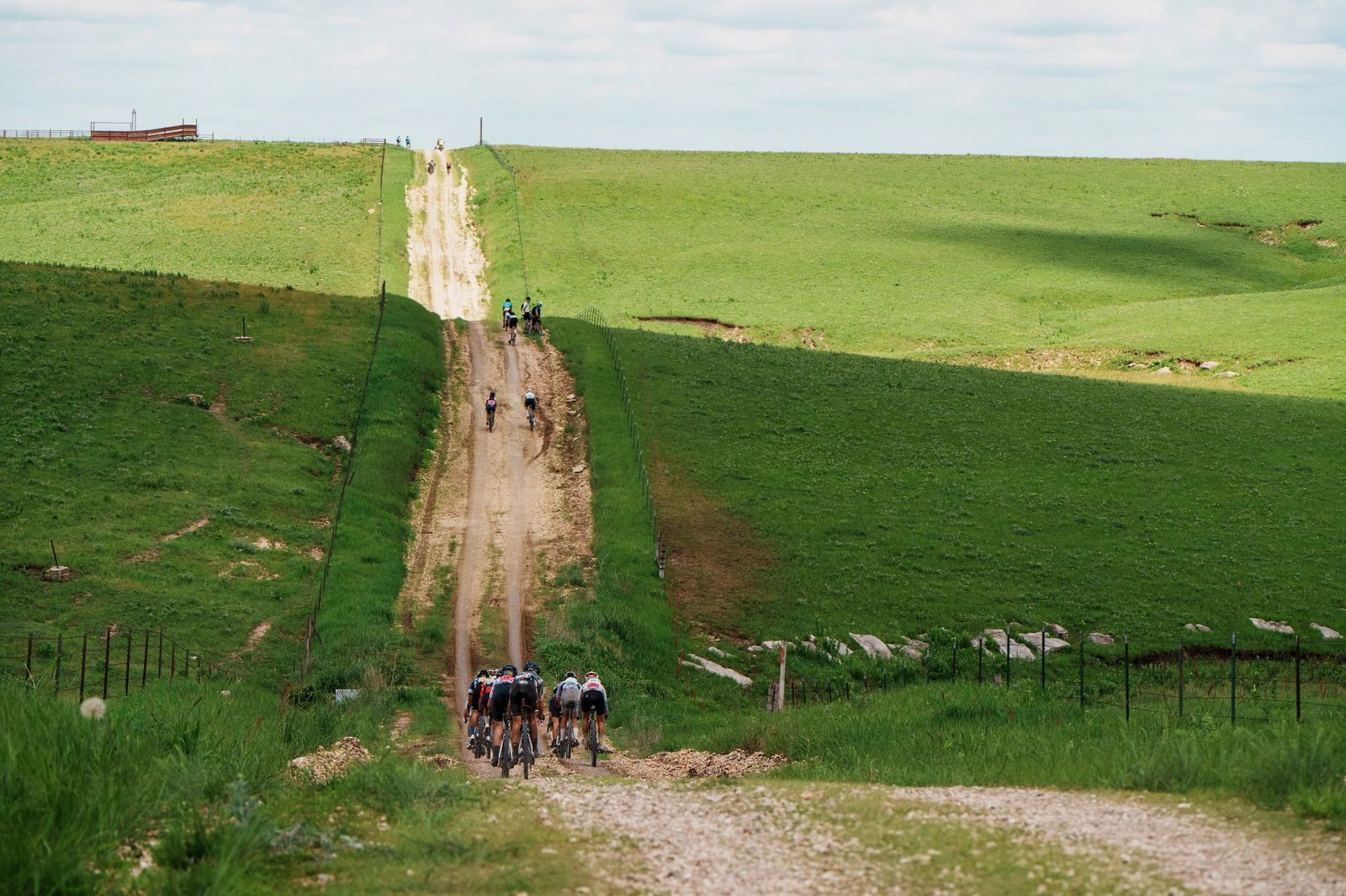
Headed both south and north of Emporia, Kansas, the 206-mile elite course features infamous sectors like Texaco Hill, Teeter Hill, Kahola dam and the 10-mile Sharpes Creek Road, which was last used in 2015 during the epic ‘mud year’.

It was founded with just 34 riders in 2006, and the 200-mile event has since evolved from a niche, self-supported adventure into the world’s premier gravel race that attracts off-road professionals, WorldTour pros and Olympians alongside thousands of amateurs.
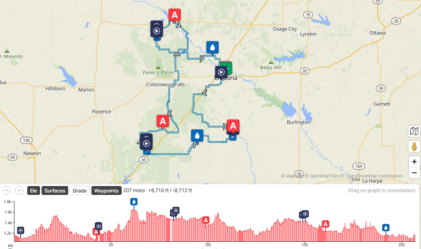

(Image credit: RWGPS)
The 200-mile flagship event starts in the early hours of May 30th in front of the Granada Theater in downtown Emporia, Kansas.
The peloton will leave downtown under neutral police escort for 3.3 miles, after which the riders are let loose to justle for position in what surely will be a fast and furious start.
The pack could start breaking up as early as 15 miles into the race on YY road, a five-mile stretch of rolling uphill the locals call “the Towers climb.”
The course’s first real climb, however, comes quickly after with the approach of the notorious Texaco Hill. It’s just 1-1.5 miles in length but steady with a loose and chunky descent on the other side.
At mile 68, another Unbound classic makes its appearance: Teter Hill. This is a prominent, challenging and often decisive climb in the race. It’s rocky and steep with grades over 10 percent.
Spirits will be tested on the 10-mile Sharpes Creek Road. It’s long, rolling and seemingly endless as you can “see for miles.” This was last used in 2015, which was the “year of the mud.” Unbound mud is unlike anything else. It bogs down bikes, rips off derailleurs and is even known to break a frame or two.
The 2026 will also feature a brand-new addition: W road, which is a chunky, rocky and grassy road with another fun feature: a creek crossing.
From here it’s onto the DD rollers, which race organisers say is “super chunky” and another bad spot for mud in case of rain.
The last big climb comes at 181 miles, the iconic Kahola Hill following the Kahola Lake dam crossing.
Then there’s one last little punch on the paved Highland Street, then two quick turns and the finish line will be in sight.
Aid stations and feed zones
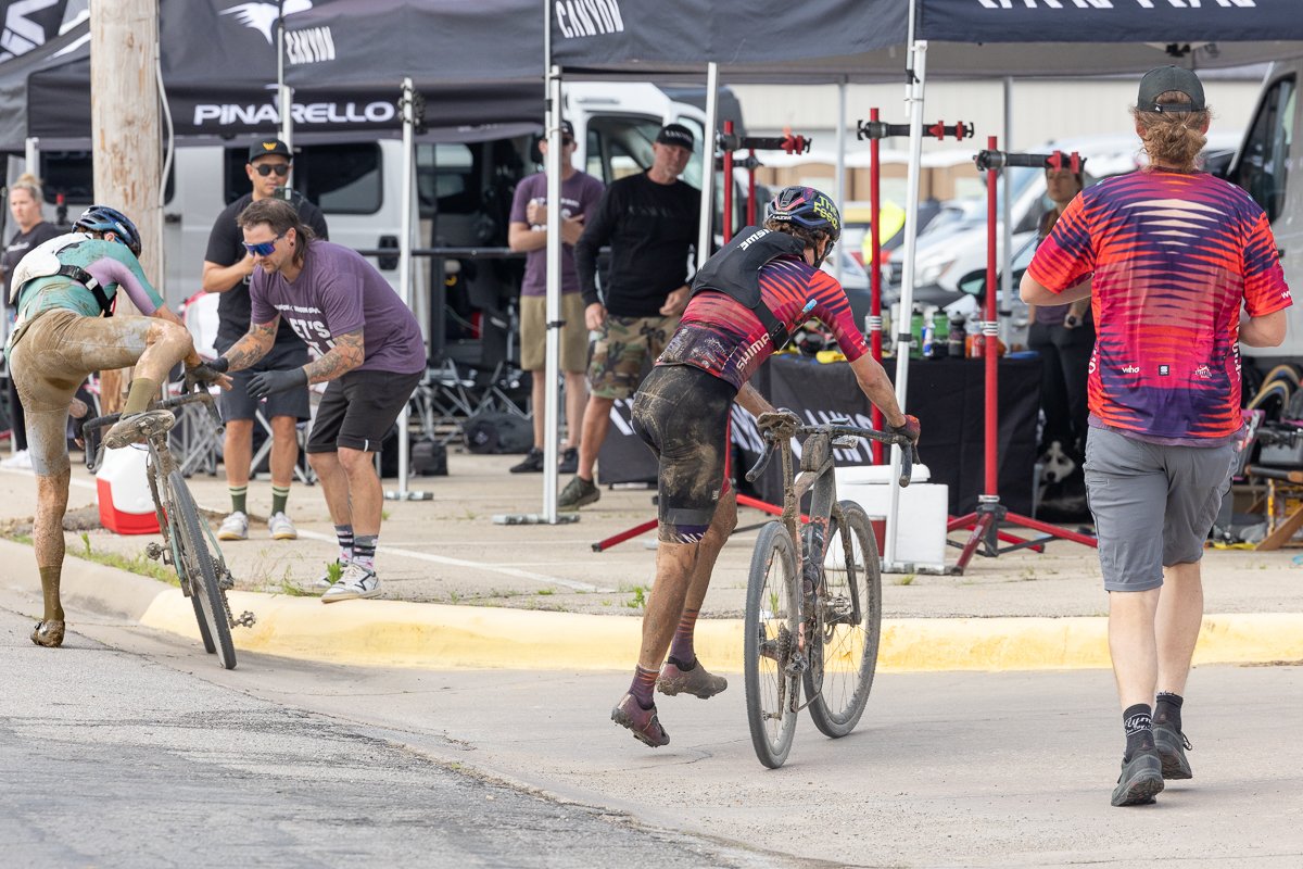

(Image credit: Snowy Mountain Photography)
A new development in 2026 is that age group and Elite checkpoints have been separated for safety reasons. Amateurs may not use the elite feedzones and vice versa.
There will be neutral mechanics, neutral water and nutrition items at the amateur checkpoints. In addition, the event will provide two neutral Water Oases. Still, organisers warn, riders should prepare to be self-sufficient.
“The Flint Hills region of east-central Kansas is an extremely remote area. Please be aware…if you break down or become injured, it is your responsibility to contact your support crew to come get you. We will not rescue you,” the event clearly states.
Age Group Checkpoints & Water Oases
- 432.3 Miles – Checkpoint 1 in downtown Madison
- 61.8 – Water Oasis
- 98.9 – Checkpoint 2 in Matfields
- 160.7 – Checkpoint 3 in Council Grove
- 191.8 – Water Oasis
Elite Feed Zones
- 43.5 miles – Start of Feed Zone 1 – Madison
- 82.2 – Start of Feed Zone 2 – Sycamore
- 148.9 – Start of Feed Zone 3 – along South 1400 Road
Explore More
Read the full article here


